THE DORSET & SOMERSET CANAL
FEATURES & WALKS
Click on map or pictures for larger versions
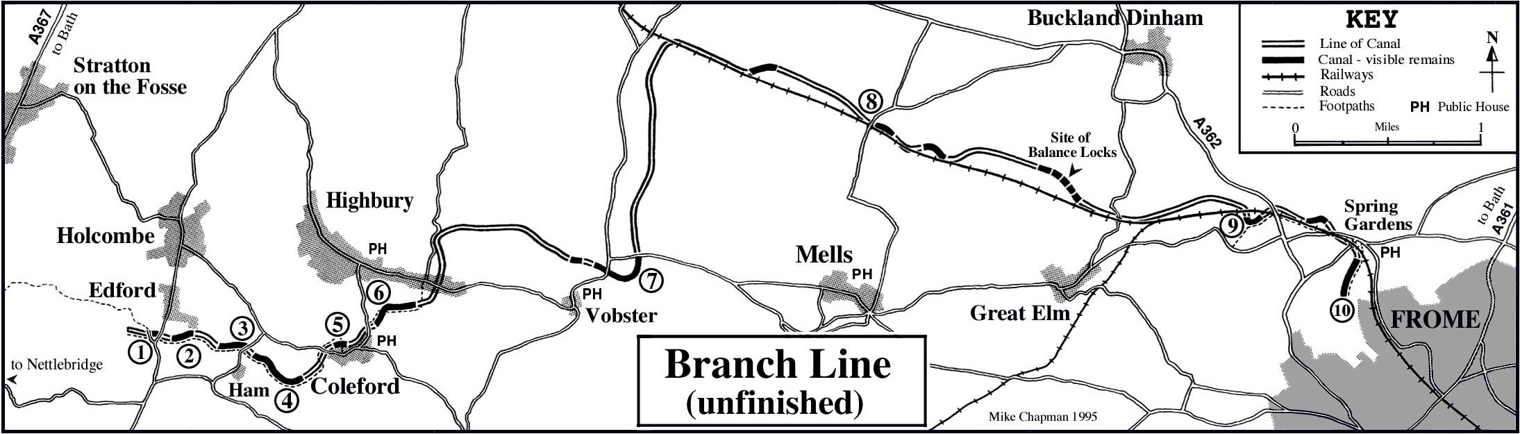
1: Edford Bridge ST
668489
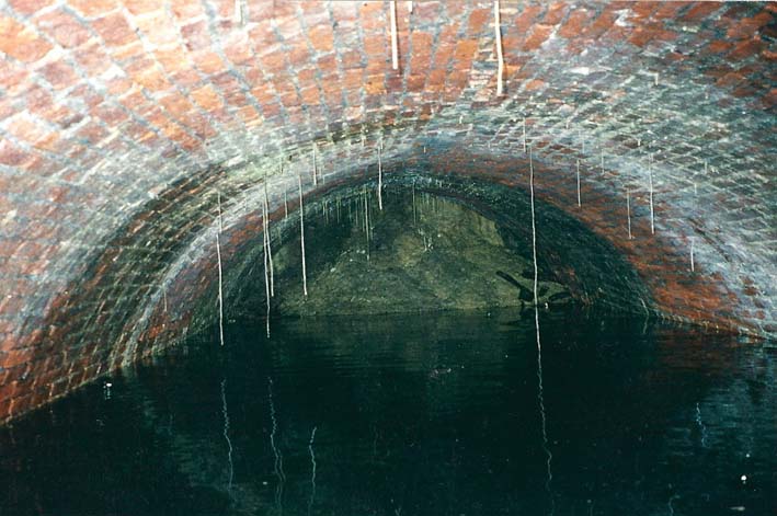
About 75 yards north of the Duke of
Cumberland, a footpath heads west (over a wooden stile)
along the bed of the canal. It leads to the old packhorse
bridge over the canal. The underside of the arch has been
infilled to prevent its collapse. The west face of the
bridge can also be seen, but the canal westwards has
disappeared. Returning to the main road, there is a
masonry-lined chamber, still retaining water.
2: Eastwards towards Ham ST
670489
Taking the footpath east, to Ham;
follow the field edge then go through the gap in the hedge.
Beyond this, the footpath follows the towpath on the south
side of the canal bed, clearly defined for some 100 yards.
In the woodland beyond, there is little trace of the canal
and the footpath is difficult to follow
3: Westwards from Ham ST
677487
Opposite a pole-mounted electricity
transformer (labelled Ham Corn Mill), a waymarked footpath
heads west over a stile, then over another stile into
woodland. It runs along the towpath for 200 yards, with the
canal bed on the north side.
4: Ham to Coleford ST
677487
From the road, over a wooden stile,
the waymarked path runs between hedges. After 100 yards the
canal becomes visible. After crossing a stile, the canal can
be followed through woodland. The path rises around the edge
of a cutting and then, after another stile, descends to
rejoin the towpath. Alongside a wooden footbridge and stile,
a short stretch of the cut retains water. The canal
disappears across an open field; follow the path along the
northern boundary of the field and beyond, to join the road
in Coleford .
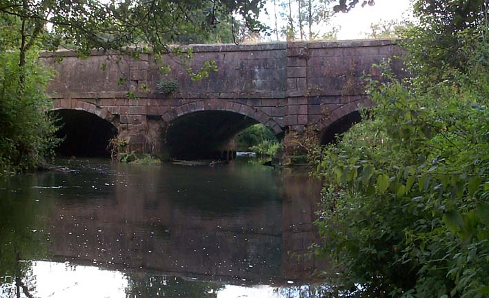
5: Coleford Aqueduct ST
685488
("Huckyduck")
From the road, a signposted
footpath heads northwards to the aqueduct. From the path,
there is a good view of the stone-faced two-arched aqueduct
which spans the valley. Although now lacking any parapet, it
was described in an 1825 pamphlet as a 'noble and stupendous
aqueduct'.
5a: Coleford Tunnel
The canal tunnel is still in
situ under the road in front of Coleford Methodist
Chapel but is not accessible to the public.
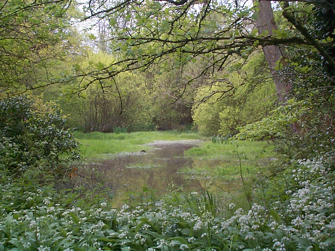
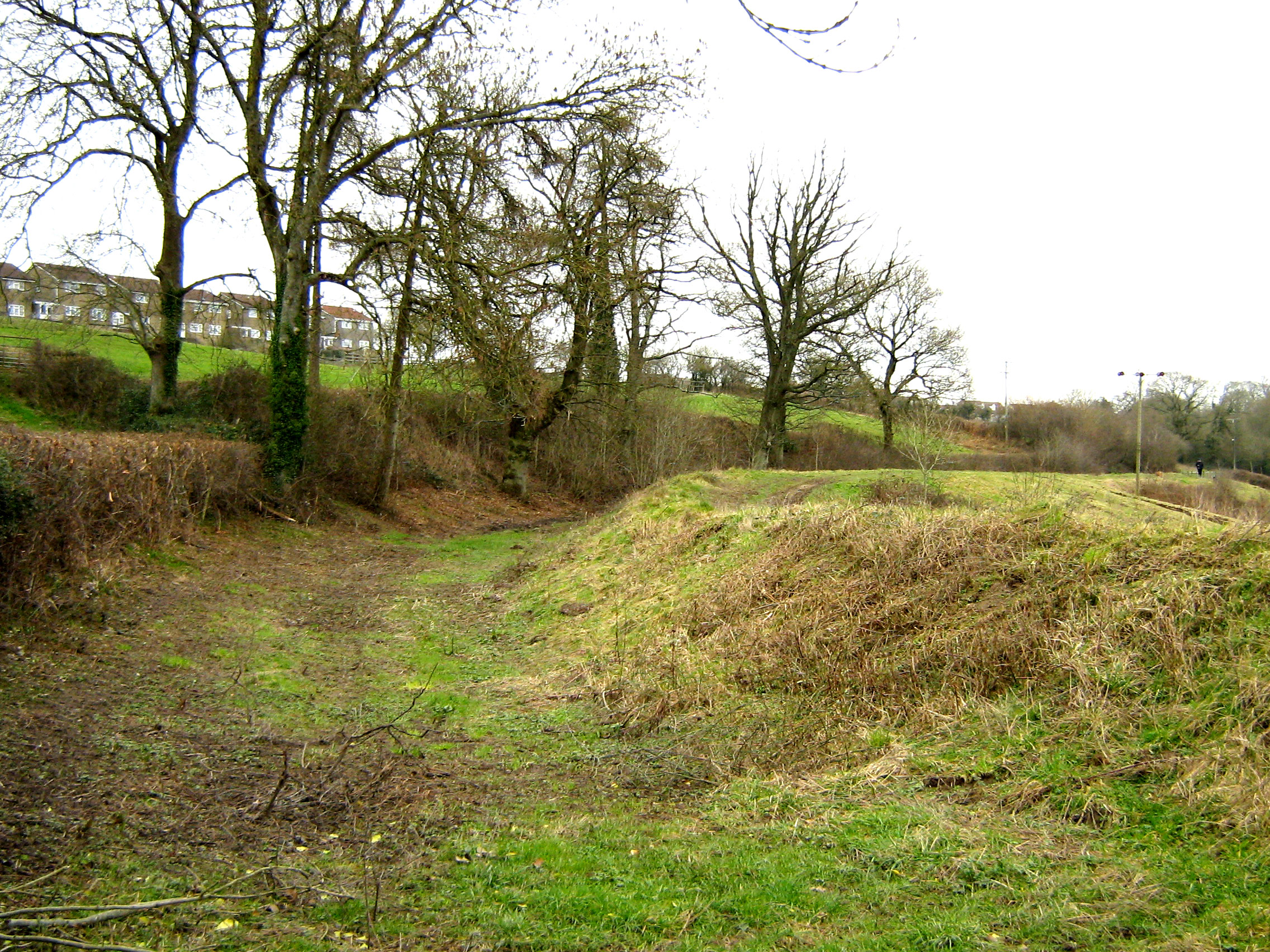
6: Coleford Embankment ST
687489
Pass through a stile in the stone
wall just north of the Methodist Church. The course of the
canal is by the line of trees. Take the path over a stile;
it continues via the towpath, over an embankment. The canal
bed disappears as it crosses a field; but reappears before
it enters a cutting which was intended to lead to a
tunnel.
7: Vobster Bridge ST
707494
Just south of Vobster Cross, the
road crosses the canal by a bridge. On the west side, the
bridge arch (filled in) and course of the canal bed can be
seen. East of the bridge, the line of the canal can be seen
as a line of trees curving round the south side of the
field.
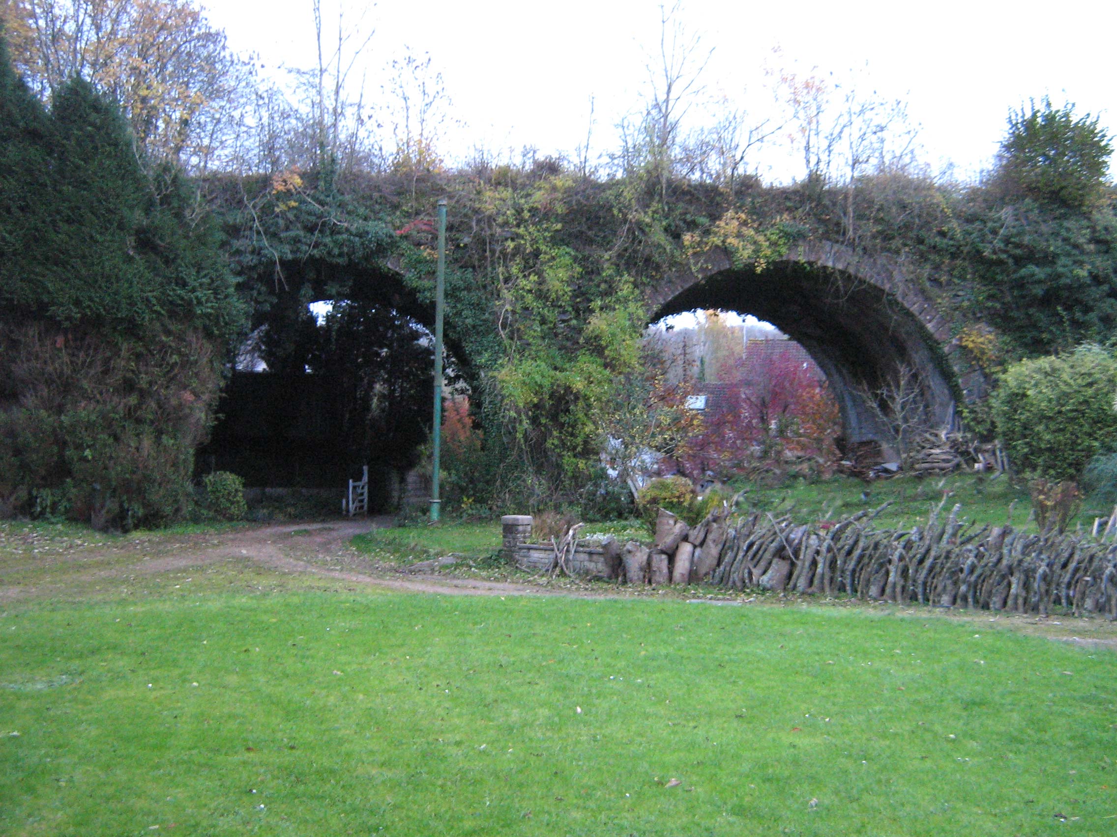
8: Conduit Bridge ST
730506
There is no footpath here, however
the bed of the canal is visible on both sides of the road,
north of the railway bridge.
9: Murtry Aqueduct ST 762498
Take the footpath from the layby at
Hapsford, over the stile. Follow the path beside the river
which leads to the aqueduct.
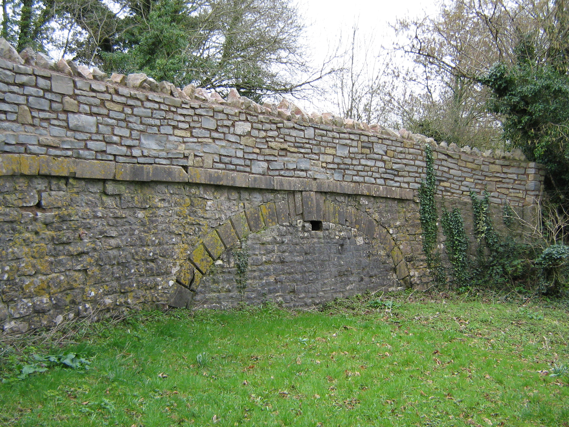
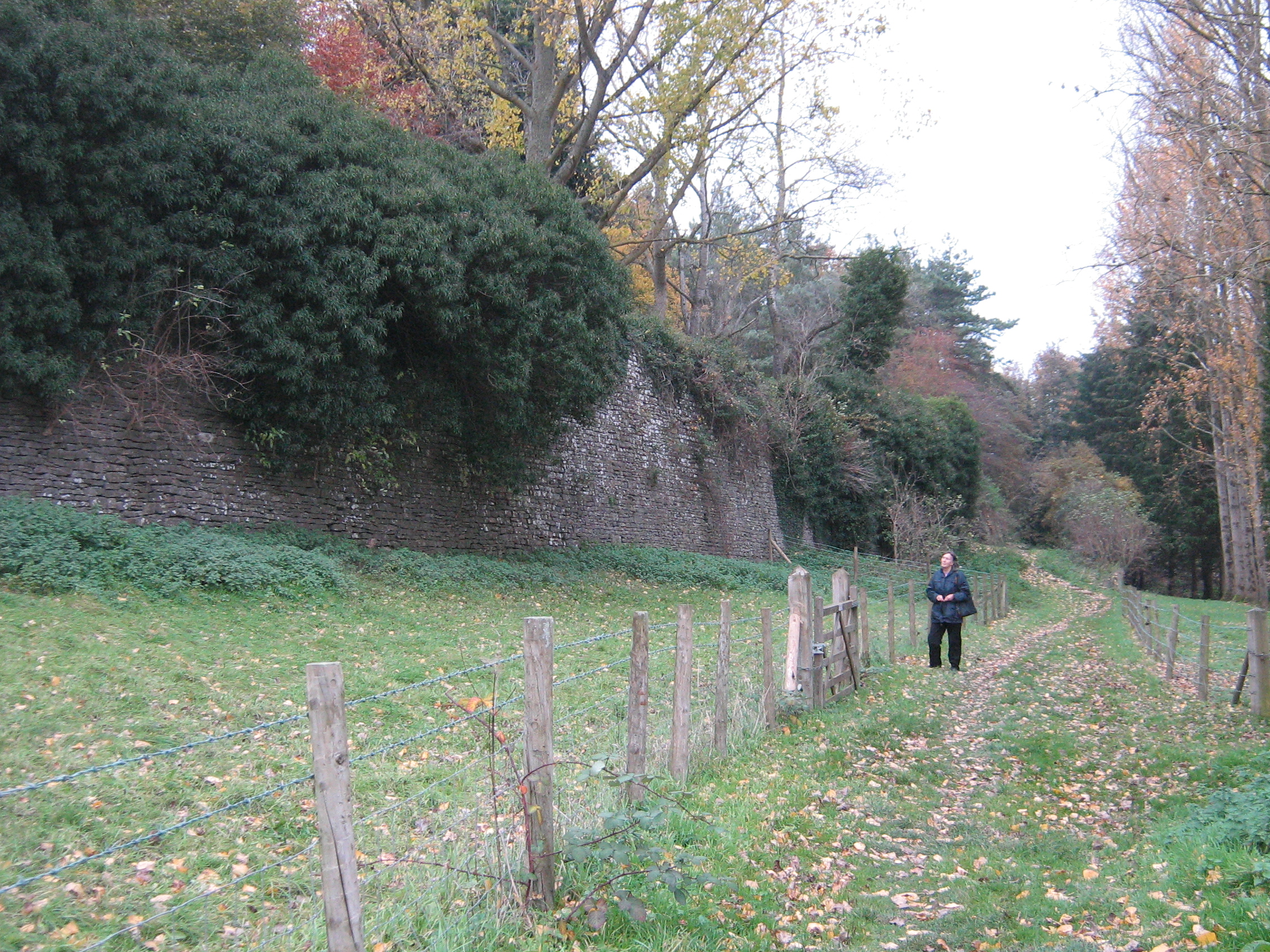
10: Whatcombe Wall ST
771494
Leave the road by a gate to cross
the railway diagonally via a footpath and through a gate.
The path gradually descends alongside an increasingly tall
stone wall which is the face of the canal embankment. A
short length of canal bed continues southwards.
Photograph: Tony
Comer
Click here to download leaflet with map